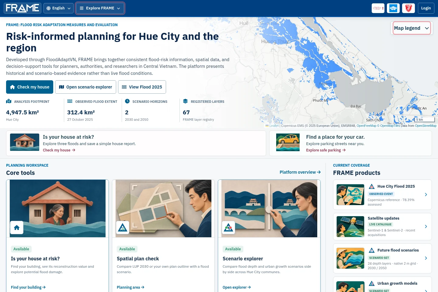
HUẾ · CENTRAL VIETNAM
Flood Risk Adaptation Measures and Evaluation
FRAME · FloodAdaptVN · BMFTR funding
Explore flood scenarios, exposure, and adaptation options for Huế and Central Vietnam.
Earth observation, open geospatial data, and practical tools for research and decision-making.
I’m Michael Schultz, an earth observation researcher based in Tübingen, Germany. I am currently Acting Professor of Remote Sensing at Friedrich Schiller University Jena, with academic affiliations at the University of Tübingen and the University of Jena.
I connect satellite observations, machine learning, and open data with questions about land use, climate, infrastructure, and environmental change.
FRAME · FloodAdaptVN · BMFTR funding
Explore flood scenarios, exposure, and adaptation options for Huế and Central Vietnam.
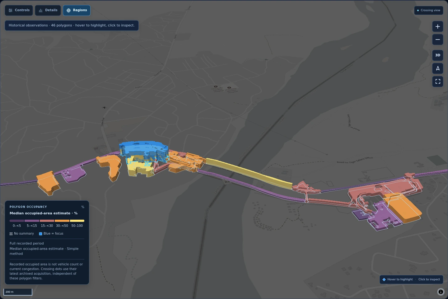
World Bank · Border Observatory
Satellite-based vehicle-occupancy estimates for studying congestion and African trade. Explore the Chirundu crossing in 3D.
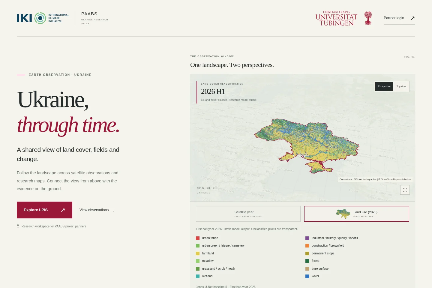
International Climate Initiative (IKI) · GIZ
Supporting Ukraine in the implementation of the Paris Agreement and adaptation to the impact of climate change in the Black Sea region (PAABS). My contribution: land monitoring for greenhouse-gas reporting.
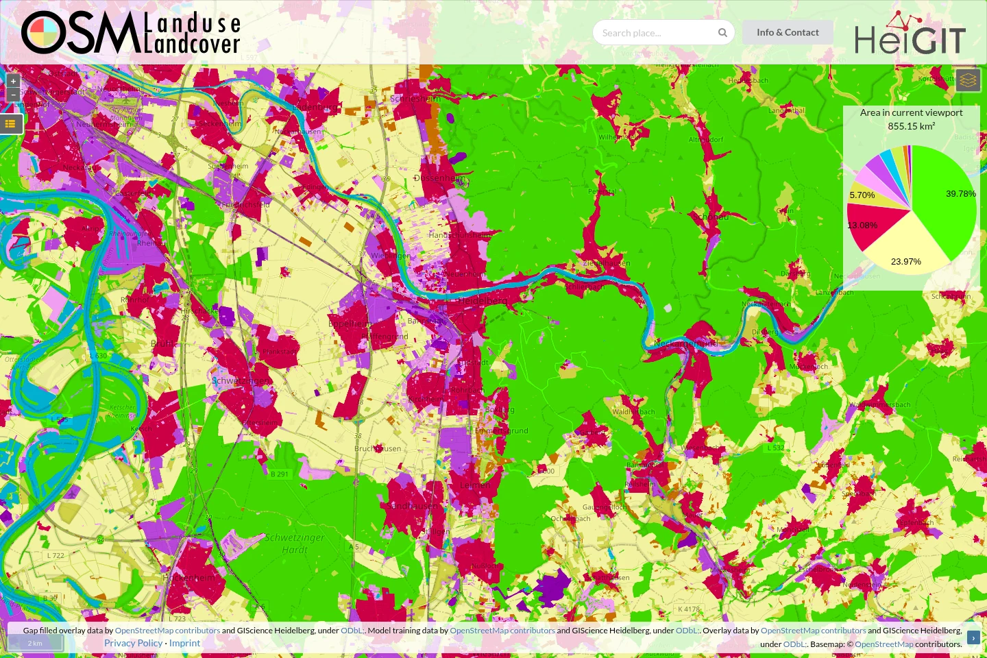
Heidelberg University · HeiGIT
Land use and land cover from OpenStreetMap, with satellite-based gap filling. Co-led with Alexander Zipf and developed with colleagues in Heidelberg.
Portal previews and a 3D overview of Chirundu · November 2026. Open a portal to explore the current site, or view its screenshot.
Earlier work on REDD+, greenhouse-gas estimation and forest conservation, from Vietnam and Lao PDR to southern Africa.
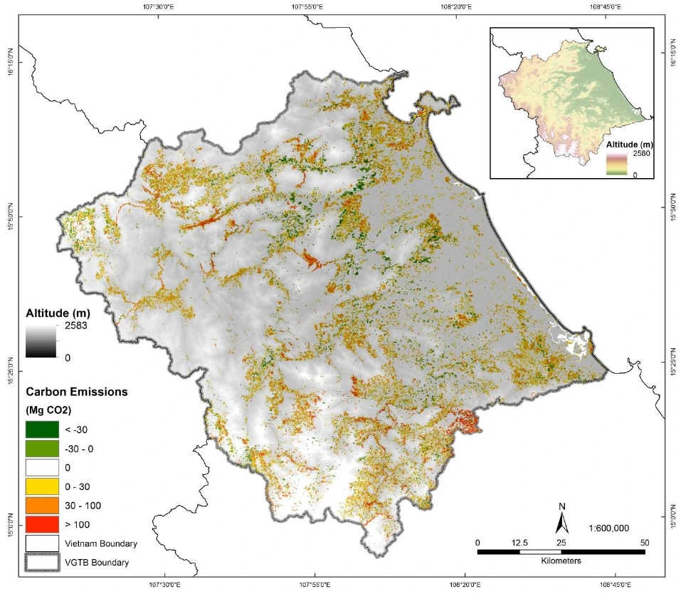
Jena · Wageningen · WWF / Österreichische Bundesforste
Greenhouse-gas estimation from land-use change: forest-carbon research in Central Vietnam and VCS-oriented REDD+ monitoring in Xe Pian, Lao PDR.
Vietnam map: Avitabile et al. (2016), reproduced in Schultz (2018), Fig. 2.5.
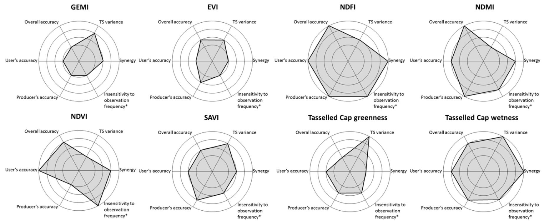
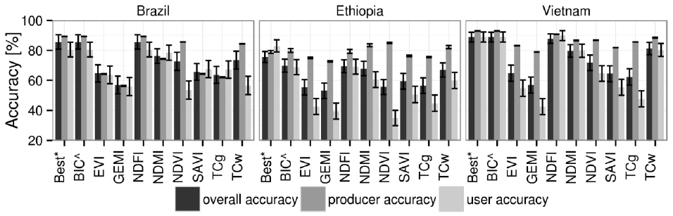
PhD thesis · Wageningen University
My doctoral research on deforestation monitoring, including a 2016 comparison of eight Landsat vegetation indices across Brazil, Ethiopia and Vietnam.
Schultz et al. (2016), reproduced in Schultz (2018): Fig. 4.7 (spider plots) and Fig. 4.3 (bar plots).
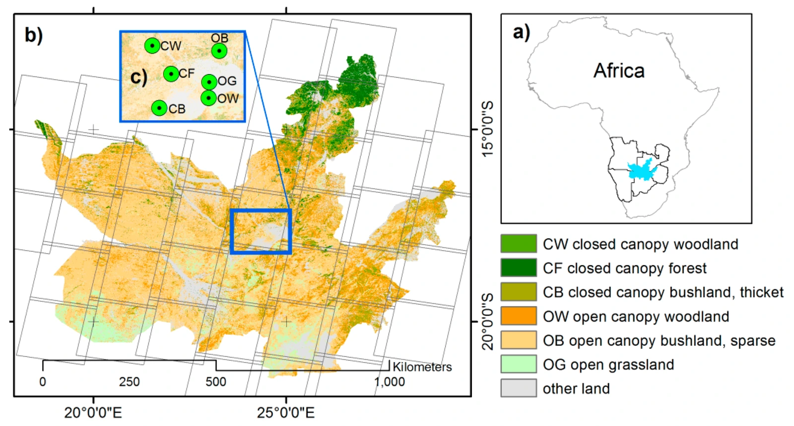
WWF · Peace Parks Foundation
Landsat forest-change monitoring in the Kavango–Zambezi conservation area (KAZA), with field validation, operational workflows and local training.
Further greenhouse-gas research: land-use carbon fluxes in Baden-Württemberg (2023) and street-level vehicle emissions in Berlin (2023).
Explore the methods, places, and questions connecting my projects.
Science of Remote Sensing · 13 · 100358
Scientific Data · 12(1) · 750
Explore 63 verified research outputs, including 20 journal articles, with citations and bibliography downloads. See 3 upcoming conference contributions and 3 current manuscripts.