Projects
From flood resilience in Vietnam to land monitoring in Ukraine: research, platforms, and open data you can explore.
Flood Risk Adaptation Measures and Evaluation
FRAME · FloodAdaptVN · BMFTR funding
How can flood-risk research become something people can explore and use? My work on FRAME connects geospatial data, flood scenarios, and accessible web tools for Huế and Central Vietnam.
The platform is part of FloodAdaptVN: Integrating Ecosystem-based Approaches into Flood Risk Management for Adaptive and Sustainable Urban Development in Central Viet Nam. The current implementation phase runs from June 2025 to May 2027 and is funded by the German Federal Ministry of Research, Technology and Space (BMFTR) through the Sustainable Development of Urban Regions (SURE) initiative.
Paris Agreement & Black Sea Adaptation
International Climate Initiative (IKI) · GIZ
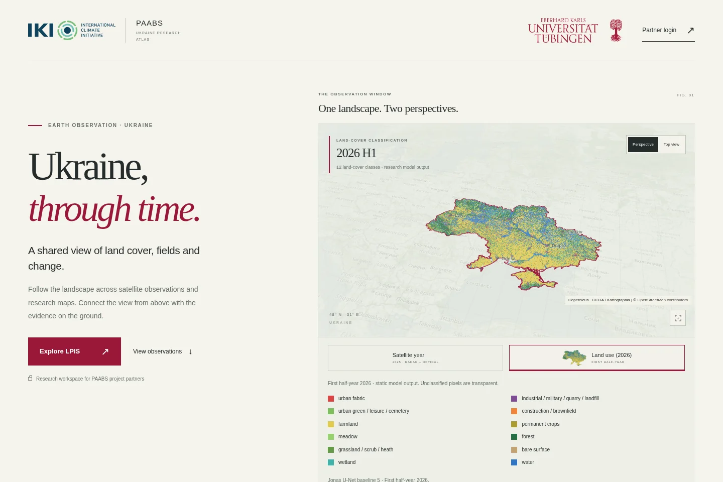
Supporting Ukraine in the implementation of the Paris Agreement and adaptation to the impact of climate change in the Black Sea region (PAABS) is funded through the International Climate Initiative (IKI) and implemented by Deutsche Gesellschaft für Internationale Zusammenarbeit (GIZ) GmbH with consortium partners.
Since October 2025, I have contributed to the programme’s land-monitoring work in Ukraine. In 2026, I coordinated land-use and land-cover classification combining Sentinel-2 observations, OpenStreetMap-derived training data, and reproducible processing workflows.
My paabs.de research atlas makes this land-monitoring work accessible to project partners. The work supports Ukraine’s Land Parcel Identification System and land-use, land-use-change and forestry reporting. It connects detailed satellite mapping with the information needed for climate policy.
Trade Fluidity & Border Monitoring
World Bank · Border Observatory
Satellite-based monitoring of vehicle occupancy supports research on congestion, logistics and trade at African border crossings. Move from an Africa-wide overview to individual border crossings, then explore how estimated occupied area varies across the observation archive. This interactive viewer connects map features with historical satellite-derived summaries.
OSM Land Use
Heidelberg University · HeiGIT
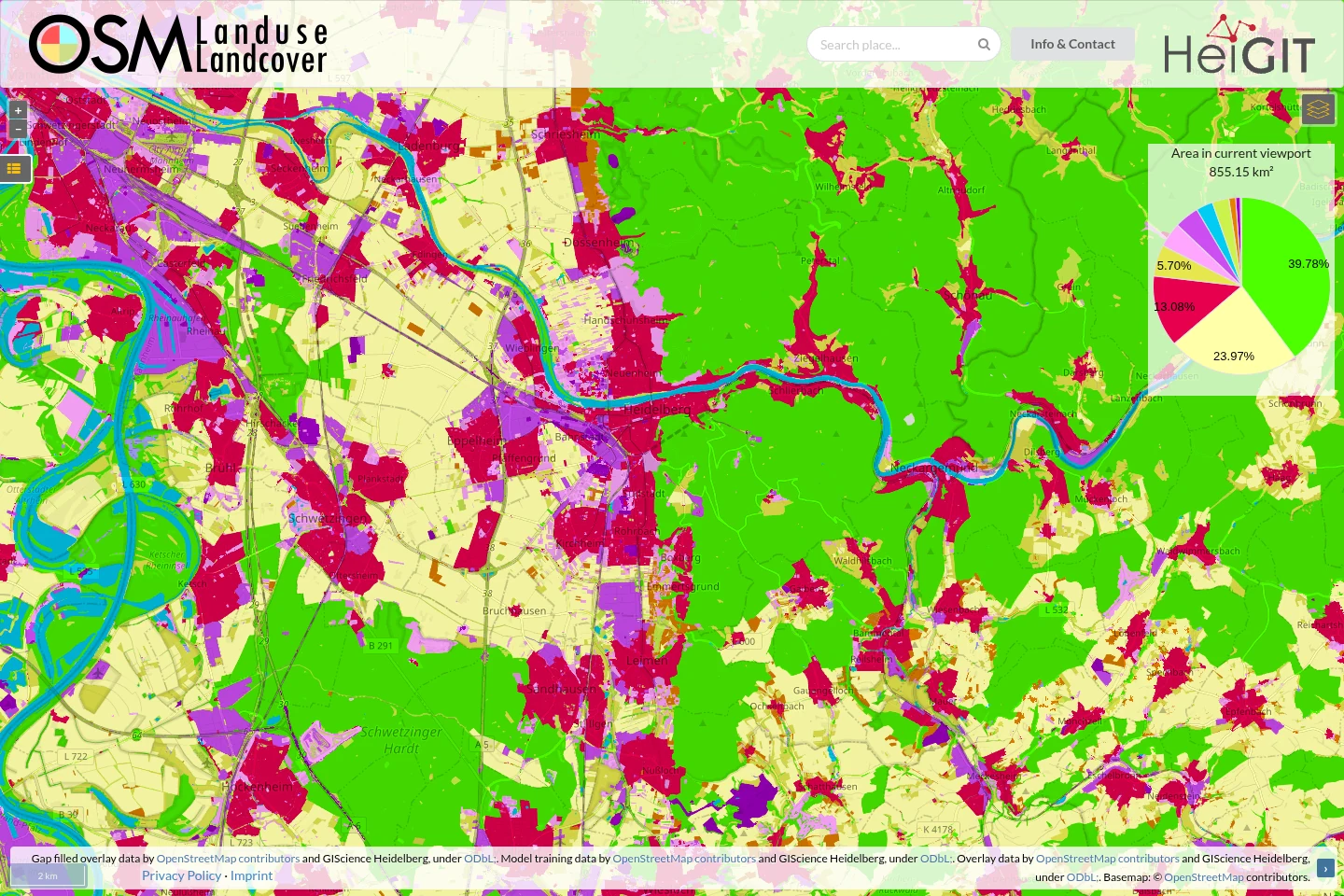
Explore OpenStreetMap’s land-use and land-cover information through the interactive OSM Landuse Landcover platform. I co-led the project with Alexander Zipf, working with colleagues at Heidelberg University and HeiGIT.
My contribution includes the deep-learning methods for filling gaps in OpenStreetMap coverage using Sentinel-2 imagery, developed with Hao Li and Zhaoyan Wu. The website was developed by Michael Auer and Moritz Schott; the platform’s “Info & Contact” section credits the wider team.
The associated 10-metre European land-use dataset combines OpenStreetMap and Sentinel-2, connecting volunteered geographic information with satellite observations and deep learning.
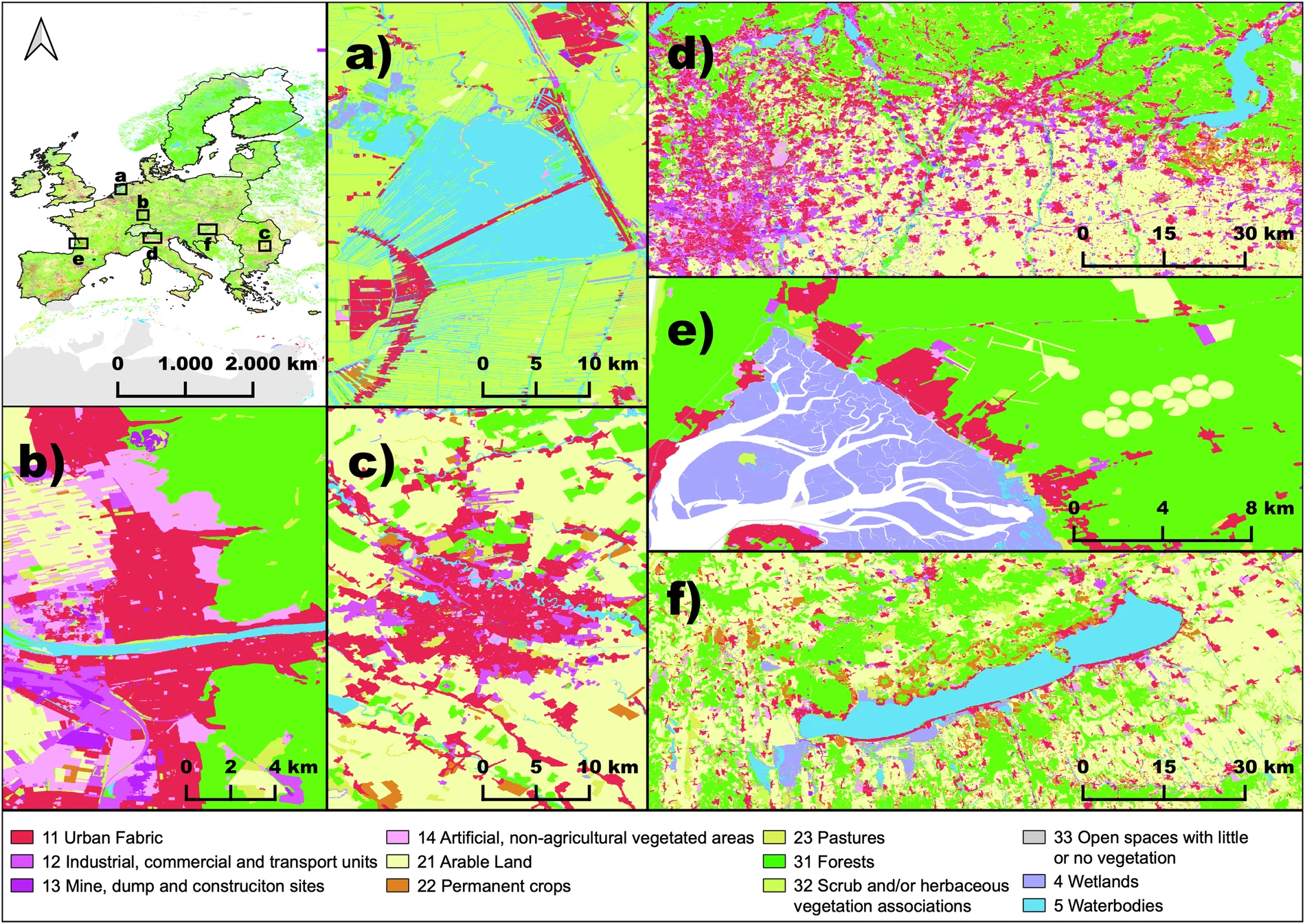
Schultz et al. (2025), Fig. 2 · CC BY 4.0. Map data © OpenStreetMap contributors.
Past work & experience
Earlier research and consulting on forest monitoring, REDD+ and greenhouse-gas estimation, with work in conservation landscapes and climate reporting.
Forest carbon & greenhouse-gas estimation
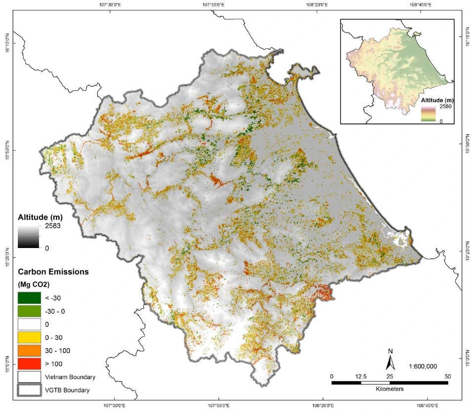
Within LUCCI, my work connected satellite time series with forest-change mapping and carbon accounting. The 2016 Carbon Management study combined Landsat land-cover observations with forest inventories to estimate carbon emissions and removals in the Vu Gia Thu Bon basin, including biomass and soil carbon.
The 2017 chapter Forest Change and REDD+ Strategies connects forest monitoring and carbon assessment with local REDD+ planning.
REDD+ monitoring for forest-carbon projects
I contributed remote-sensing and time-series workflows to the Xe Pian REDD+ project in Lao PDR, working with Österreichische Bundesforste and WWF. My work included baseline modelling, land-use-change analysis, reporting, ground-reference validation, audit support and training for local staff.
The work supported project preparation and monitoring under the Verified Carbon Standard (VCS). It linked satellite-based activity data with the information needed to estimate forest-carbon emissions and establish a reference baseline.
Tropical Forest Monitoring
PhD thesis · Wageningen University
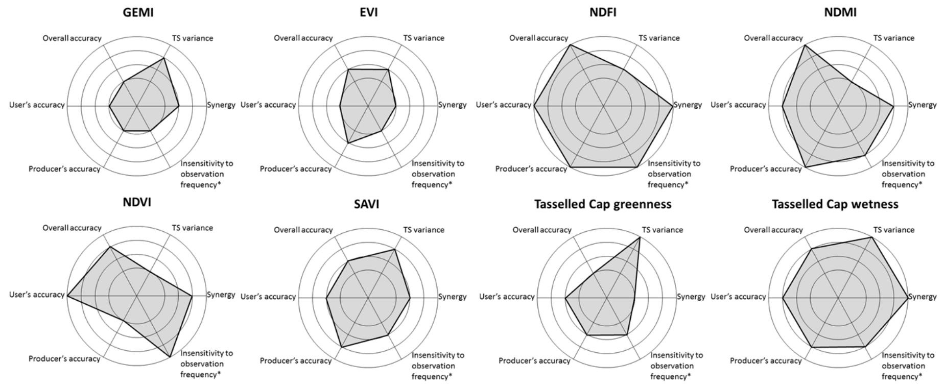
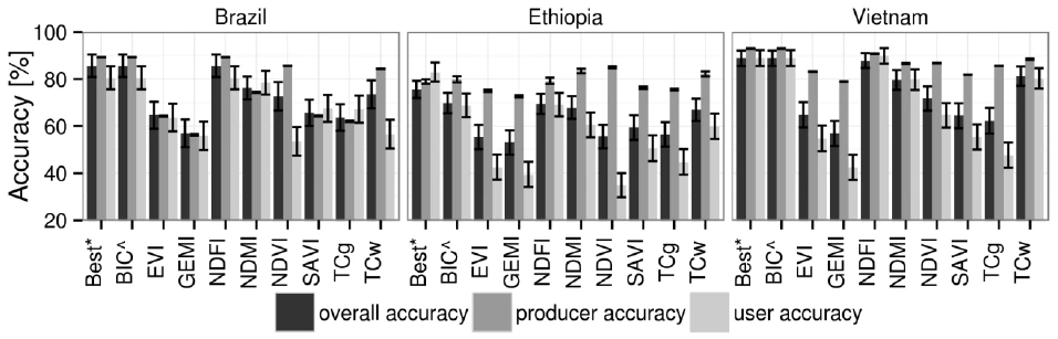
Which satellite indices best reveal forest loss? My 2016 study compared eight Landsat vegetation indices with BFAST Monitor across tropical sites in Brazil, Ethiopia and Vietnam. It examined detection accuracy and the effects of vegetation signals, clouds and observation availability.
A companion 2016 study investigated error sources in BFAST Monitor. Both studies form part of my 2018 Wageningen doctoral thesis on tropical deforestation monitoring.
Kavango–Zambezi Monitoring
WWF · Peace Parks Foundation
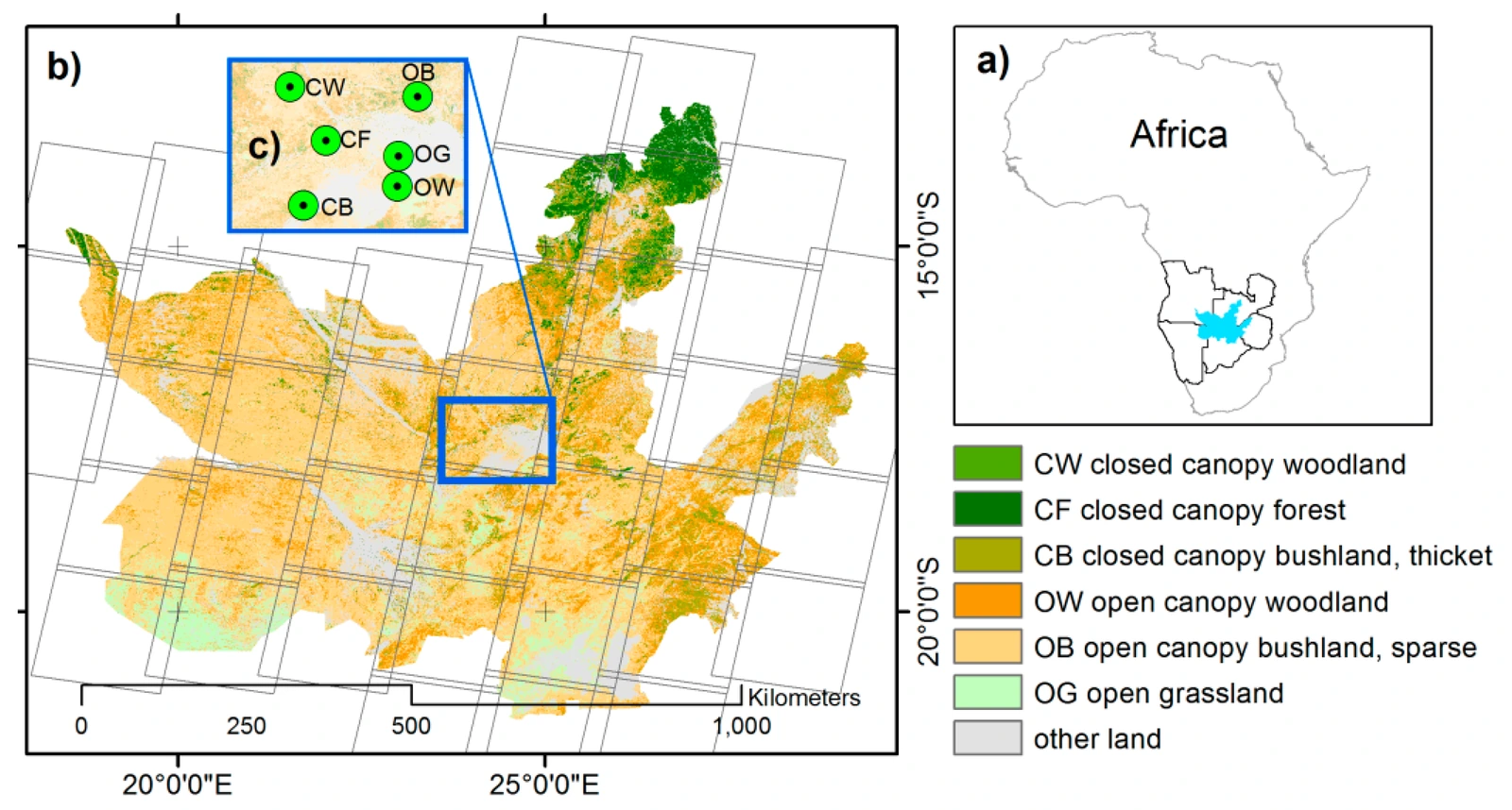
Working with WWF and Peace Parks Foundation, I developed Landsat-based land-cover and vegetation-change monitoring for the Kavango–Zambezi Transfrontier Conservation Area. The work connected field validation, operational processing workflows and staff training with conservation monitoring.
The associated 2018 paper examines forest-cover and vegetation degradation detection using BFAST Monitor. Field validation in Zambia and Namibia helped connect satellite-based change estimates with conditions on the ground.
Emissions across land use and transport
My later work extended spatial greenhouse-gas estimation to land-use change and road transport. The 2023 studies address carbon fluxes in Baden-Württemberg and street-level private-vehicle emissions in Berlin using open data.